12 Best Hiking Trails Near Tulsa From a Local

If you’re looking for an outdoor adventure but don’t want to go too far from Tulsa, you’re in luck. We live here, and there are plenty of great trails to explore. Here are the best hiking trails near Tulsa.
Best Hiking Trails To Explore in and Around Tulsa
1. Keystone Singletrack (Big Loop) Trail
- Location: Near Keystone Lake in Mannford, Oklahoma
- Difficulty: Easy
- Distance: 4.2-miles
- Time to Hike: ~ 2 hours
- Parking: Parking lot, right off the highway, lots of space
- Dog Friendly: Yes, on a leash
- Cost: Free
- Restrooms: None
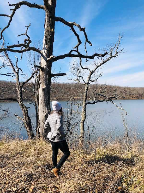
Proximity to Tulsa: Close to Keystone Lake State Park, the Keystone Singletrack (Big Loop) Trail is an enjoyable hike 15-20 minutes from downtown Tulsa.
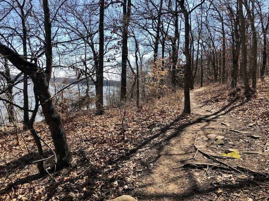
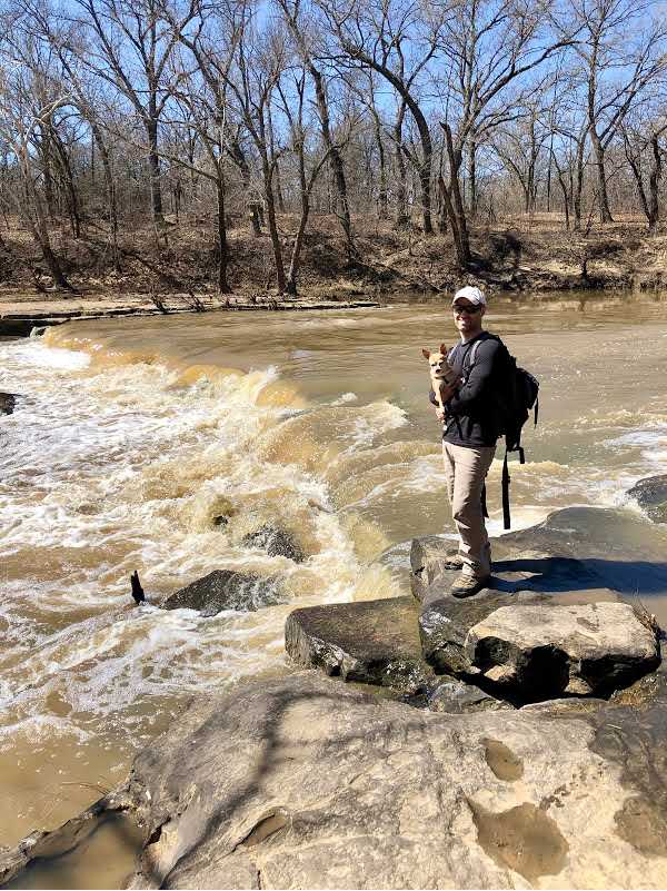
Trail Details: The trail meanders through rolling hills and dense woods, along with scattered rock outcroppings. One of the rock outcroppings is named Dragon’s Spine. There are a few trickling stream crossings to hop across.
The trail is marked with blue spray paint or blue arrows. The path loops back towards the Arkansas River to the top of a hill, where you will be greeted with views of the Arkansas River.
Why We Love This Hike: This is a nice hike close to the city if you want to get outdoors for fresh air and a change of scenery. There is moderate traffic, including hikers, mountain bikers, and dirt bikers. Overall it is a quiet and peaceful hike.
2. Keystone Ancient Forest Preserve Trails
- Location: Keystone Ancient Forest Preserve near Sand Springs, Oklahoma
- Difficulty: Easy
- Distance: Multiple trails
- Time to Hike: ~ 2-3 hours
- Parking: Yes, parking lot with lots of space
- Dog Friendly: Yes, but only on the 1st Saturday and 3rd Sunday of each month
- Cost: Free
- Restroom: Yes, inside of the visitor center
- Hours: Open Thursdays from 7 am – 2 pm and Friday through Sunday 7 am – 6 pm

Proximity to Tulsa: The Keystone Ancient Forest is located about 20 minutes west of Tulsa. The area has moderate traffic, is well-maintained, has a beautiful visitor center, and the paths are all well-marked.
Trail Details: There are multiple trails to hike within the nature preserve:
- Fire Road – 0.8 miles one-way
- Childers Trail – 6/10 mile loop + handicap accessible
- Frank Trail – 1.4 miles one way – add on to the big loop
- Less Traveled Trail – 4.1 miles one way (this is the main big loop)
- Wilson Trail – 1.0 mile one-way
- Falls Trail – 3.5 miles one-way
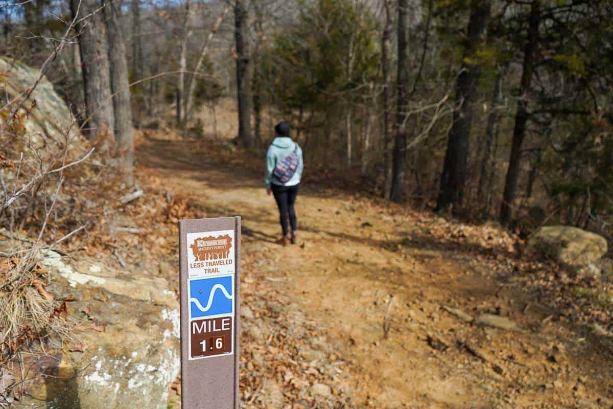
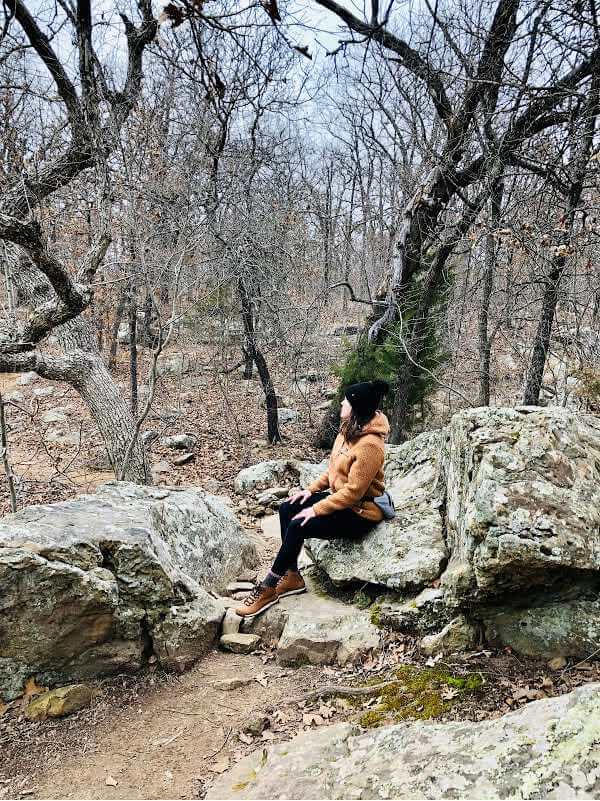
Why We Love Hiking Here: Our favorite trail is called the Less Traveled Trail. It wanders through the woods, part of it is graveled, and part is just dirt. Overall, it is open and easy to follow. Hiking here makes for the perfect morning or afternoon adventure.
The Keystone Ancient Forest is home to 500-year-old Cedars and 300-year-old Post Oak trees. This forest is listed as a nature preserve by The Nature Conservancy.
3. Bixhoma Lake Loop Trail
- Location: Bixhoma Lake near Bixby, Oklahoma
- Difficulty: Easy
- Distance: 3.3-miles
- Time to Hike: ~ 1 ½ – 2 hours
- Parking: Plentiful areas to park around the lake
- Dog Friendly: Yes, on a leash
- Cost: Free
- Restrooms: Portable lavatory

Proximity to Tulsa: Lake Bixhoma is 40 minutes from downtown Tulsa near Bixby, Oklahoma. The area gets rural fast (Leonard Mountain).
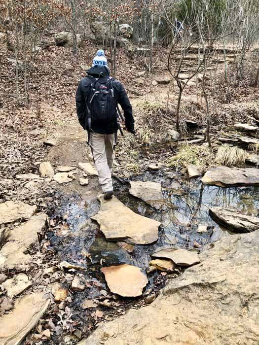
Trail Details: You can hike the Bixhoma Lake Loop counterclockwise or clockwise. Stop and see the waterfall at the end of your loop downstream of the dam.
The trail follows a dirt road some of the way around the lake, then tapers into a single track through the trees. There is one stream crossing on the south side of the lake, which feeds the reservoir. The stream crossing consists of large rocks to skip across.
Why We Love Hiking Here: There isn’t much foot traffic during the hike, but you can tell the trail is used. Highlights include views of the lake, a quiet nature feel, and armadillos roaming the woods.
Towards the northern part of the lake, a goat and donkey grazing restoration project is underway, so you might see them.
4. Sawtooth Loop Trail: Part of the Claremore Mountain Bike Trail System
- Location: Near Claremore, Oklahoma
- Difficulty: Easy
- Distance: 2.1-miles
- Time to Hike: ~ 1 ½ hours
- Parking: Parking lot on the east side of Claremore Lake off of E 470 Road (Lake Road)
- Dog Friendly: Yes, on a leash
- Cost: Free
- Restrooms: Portable lavatory

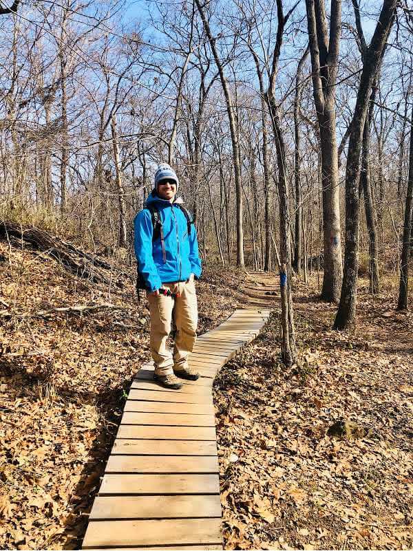
Proximity to Tulsa: Located 35 minutes from downtown Tulsa, the Claremore Mountain Bike Trail System is a hidden gem. Tucked in the woods against Claremore Lake, the community has built an excellent trail system for hikers and bikers.
Trail Details: There are multiple loops to trek or bike. The trails are marked by red, yellow, purple, and blue colors.
Why We Love Hiking Here: It’s an easy maze of paths to wander. From Tulsa, you can opt to drive the historic Route 66 route to Claremore (which is what we like doing). Be sure to stop at the Blue Whale, a darling roadside attraction.
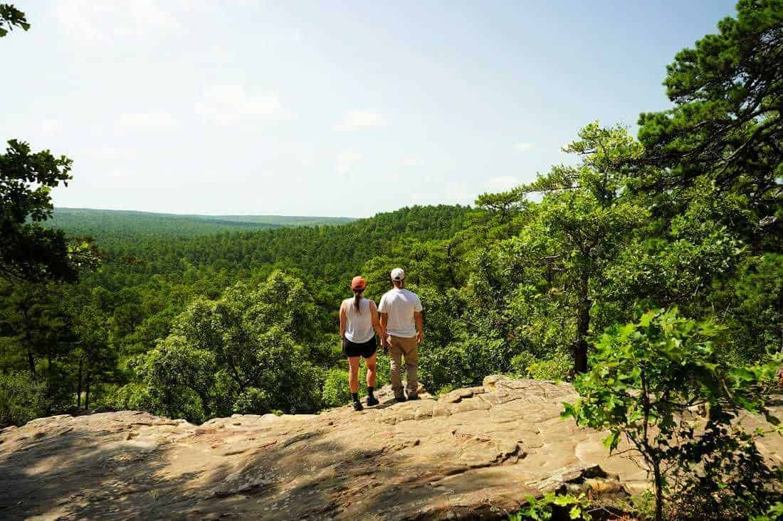
5. Dripping Springs Trail in Natural Falls State Park
- Location: Natural Falls State Park near Colcord, Oklahoma
- Difficulty: Moderate due to steep downhill/uphill + some stairs
- Distance: 1 mile loop
- Time to Hike: ~ about an hour
- Parking: Plentiful parking at the state park
- Dog Friendly: Yes, on a leash
- Cost: $10 Entrance Fee
- Restrooms: Yes
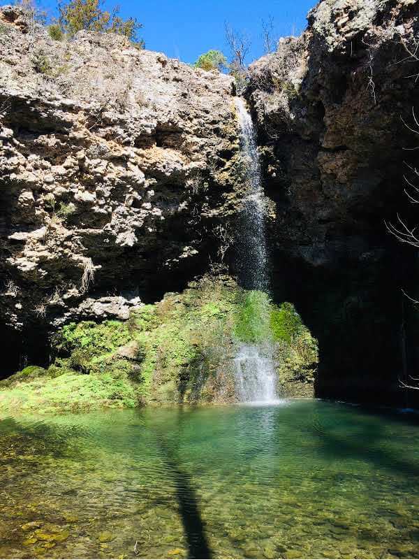

Proximity to Tulsa: Natural Falls State Park is located about 1 hour and 15 minutes east of Tulsa near the Oklahoma and Arkansas border. We decided to include this hike because visiting the park makes for an easy weekend day trip.
Trail Details: Hike the Dripping Springs Trail, Oklahoma’s famous 77′ waterfall. Some of the trail is paved, there are stairs, and then you will wander a single dirt track to a small lake beneath the bluffs.
Why We Love Hiking Here: The Dripping Springs waterfall was featured in the film Where the Red Fern Grows, based on Wilson Rawls’ novel. This was actually one of my favorite books as a kid, and it was cool to visit this place in real life when we moved to Oklahoma.
After your hike, head on to Siloam Springs, Arkansas, to have lunch. Siloam Springs is a cute town.
6. Red Bud Valley Oxley Nature Preserve: Main Trail to the Bluff Trail
- Location: Catoosa, Oklahoma
- Difficulty: Easy to moderately difficult
- Distance: About 1.2 miles (there are a few trails to explore if you choose a different route)
- Time to Hike: ~ 1 hour
- Parking: Plentiful inside the park or along the county road
- Dog Friendly: No pets
- Cost: Free
- Restrooms: Yes
- Hours: Saturday-Sunday, 8 am to 5 pm
2024 Update: The nature preserve is temporarily closed so the area can rest and recover. Please check their website for the most updated schedule.

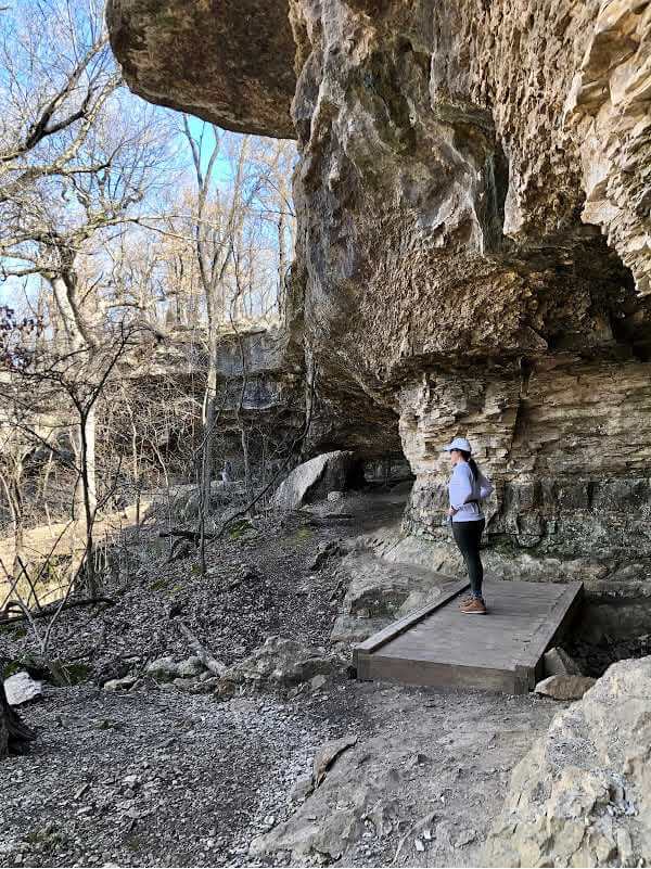
Proximity to Tulsa: The Red Bud Valley Oxley Nature Preserve is located roughly 30 minutes northeast of Tulsa. The Nature Preserve is part of The Nature Conservancy.
Trail Details: Start the hike on the main trail near the parking area. You will wander uphill through the Oak and Hickory trees. The trail will fork after a while, and you can choose to adventure along the Bluff Trail.
Why We Love Hiking Here: The Bluff Trail gets more rugged, and you have to watch your step. You’ll hike along a limestone ridge with rock outcroppings, a cave, and a trickling stream before going back downhill toward the parking lot.
7. Prairie Earth Trail in the Tallgrass Prairie Preserve
- Location: Tallgrass Prairie Preserve near Pawhuska, Oklahoma
- Difficulty: Easy
- Distance: 2.9-miles
- Time to Hike: ~ 1 ½ hours
- Parking: Parking area and trail signage near the visitor center
- Dog Friendly: Yes, on a leash
- Cost: Free
- Restroom: Yes, at the visitor center


Proximity to Tulsa: The Prairie Earth Trail is roughly 1 hour and 45 minutes north of Tulsa. Don’t let the proximity from Tulsa detour you. It is one of the best hiking trails.
Trail Details: You’ll see the trail sign once you get close to the visitor center. Start on the Nature Trail, then the trail branches to lead hikers further along the Prairie Earth Trail.
You’ll wander through the vast open tallgrass prairie; then, the trail will take you back into the trees near Sand Creek. Enjoy wide-open spaces with views for miles. The prairie is incredibly breathtaking and remarkable for walking and clearing the mind.
Why We Love Hiking Here: The Tallgrass Prairie Preserve is the largest tallgrass prairie in the world and is home to over 2,500 free-ranging buffalo. While driving to the trailhead, which is close to the visitor center, keep your eyes peeled for buffalo. The Tallgrass Prairie is part of The Nature Conservancy.
8. Sand Creek Falls (Osage Hills Falls) Trail in Osage Hills State Park
- Location: Between Pawhuska and Bartlesville, Oklahoma
- Difficulty: Easy
- Distance: 0.5 mile out and back – or you can loop for roughly a mile
- Time to Hike: ~ 30 minutes out and back – or you can make a loop for 1 hour
- Parking: Plentiful. The trailhead is by the swimming pool near the south end of the park.
- Dog Friendly: Yes, on a leash
- Cost: $10 pay there, $8 for Oklahoma residents
- Restrooms: Yes

Proximity to Tulsa: From Tulsa, head north towards Bartlesville. The drive will take about 1 hour and 10 minutes to get to Osage Hills State Park.
Trail Details: To hike to the falls, park near the swimming pool in Osage Hills State Park. The trail sign is right behind the parking area. For a short hike, you’ll walk toward the water to see the iconic falls.
Depending on the time of year you hike, you may or may not be able to see the falls. We hiked in mid-March after a big rainstorm, and the falls were washed out.
In case the falls are washed out, there are a few other trails to explore in the area with neat rock outcroppings. Don’t miss the cliff views from the group camp bunkhouses.
You might also enjoy the Osage Hills Red Trail, Osage Hills Lake Trail, and the hiking loops around the campgrounds.
Why We Love Hiking Here: Pack a sack lunch, enjoy the park, then head to downtown Pawhuska or Bartlesville to explore the historic main streets. We adore both of these towns.
If you head into Pawhuska, be sure to stop at The Pioneer Woman’s famous Mercantile. The Merc is a local favorite full of Southern small town charm.
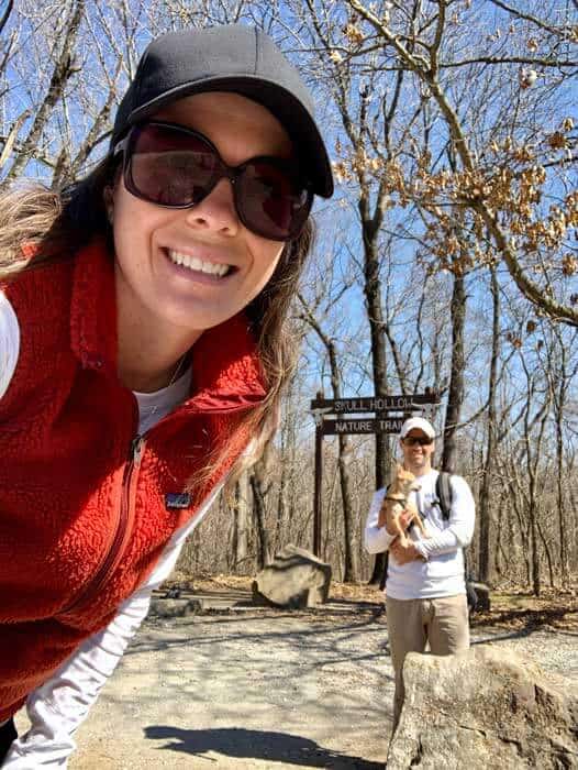
9. Skull Hollow Nature Trail
- Location: Oologah Lake, near Claremore Oklahoma
- Difficulty: Easy
- Distance: 1.2-miles
- Time to Hike: ~ 1.5-2 hours if you’re stopping to enjoy the lake views
- Parking: Plentiful
- Dog Friendly: Yes, leash requirement
- Cost: Free
- Restroom: Yes
Proximity to Tulsa: The Skull Hollow Nature Trail is tucked next to Oologah Lake. From Tulsa, it takes roughly 30 minutes to drive to the trailhead. There is plentiful parking before the trailhead.
Trail Details: The trail is well-marked with roadside markers, and the beginning of the path is marked with a rustic wood sign.
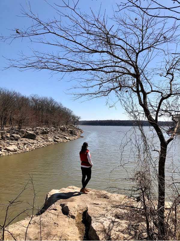
Along the trail, you’ll wander through the woods before coming to the first rock outcropping and tree clearing with views of Oologah Lake. Stop, have a snack, and enjoy the lake.
Continue trekking the loop (you’ll see a trail marker that says Long Loop), which wanders along the Oologah Lake shoreline.
Why We Love Hiking Here: Along the trail, wood signs point out the different types of native trees, such as Mockernut Hickory, Sugar Maple, and Black Walnut. Keep your eyes peeled for Armadillo. This is one of our favorite trails to hike near Tulsa.
10. Mary K Oxley Nature Center Loop in Mohawk Park
- Location: Tulsa, Oklahoma
- Difficulty: Easy
- Distance: 2.6-miles
- Time to Hike: ~ 1.5 hours
- Parking: Yes, plenty
- Dog Friendly: No
- Cost: Free
- Restrooms: Yes
- Hiking Trails Hours: The park open daily from 7 am to 9 pm
Proximity to Tulsa: The Mary K Oxley Nature Center Loop is located close to Tulsa on the north side of town. Hiking trails are accessible from Mohawk Park daily from 7 am to 9 pm.
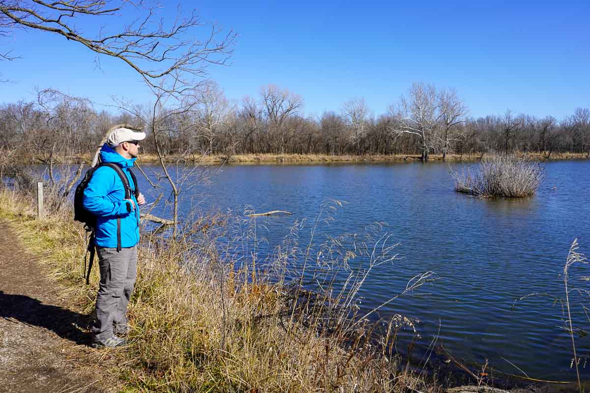
Trail Details: To do the Loop Trail, begin on the Coyote Trail or Meadow Trail. You’ll loop towards the lake. This is a nice trail system that meanders through the woods. Keep your eyes peeled for the next trail sign to pick your adventure.
Be sure to check out the Mary K Oxley Nature Center map before you go and choose your hiking route. There are a few hiking trails to choose from besides the Loop Trail.
Why We Love Hiking Here: The Oxley Nature Center provides excellent nature trails near Tulsa. Lake Sherry is also a quiet place to watch for birds, like Great Blue Herons.
11. Tulsa River Parks Trail System
- Location: Midtown Tulsa, Oklahoma
- Difficulty: Easy
- Distance: 26 miles of asphalt trails
- Time to Hike: ~ you can choose your adventure
- Parking: Multiple places – check out the Tulsa River Park Trail map
- Dog Friendly: Yes
- Cost: Free
- Restrooms: Yes

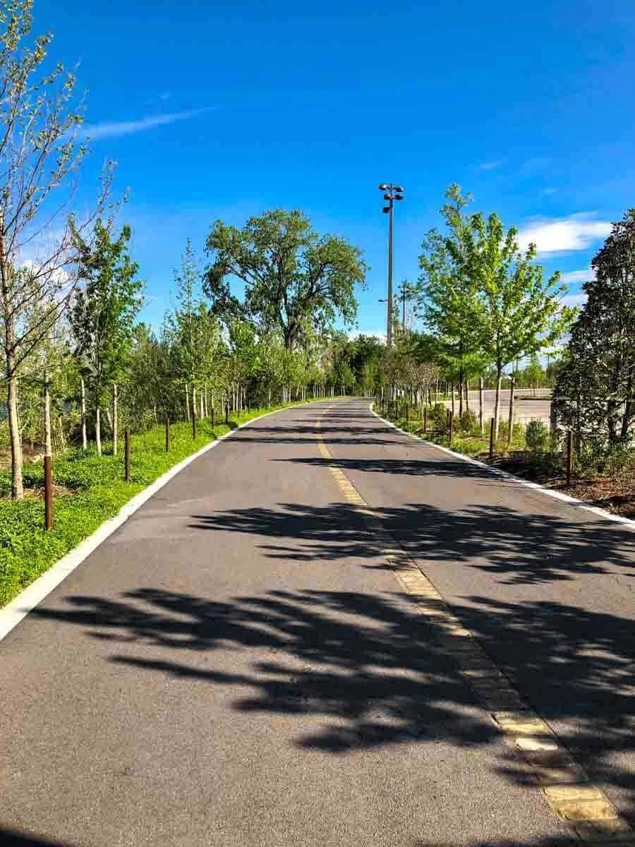
Proximity to Tulsa: One of the community’s prized gems, the Tulsa River Parks Trail system offers 26 miles of paved asphalt trails along the Arkansas River. It has the area’s best walking trails.
Trail Details: There is a paved trail along the east and west sides of the Arkansas River. Hike, run, walk, or bike with ample opportunities to see wildlife, bird-watch, get fresh air, enjoy the gardens, and experience the Gathering Place.
Why We Love Hiking Here: Close to midtown, you don’t have to go far to the city’s best place for outdoor recreation. You can head to Tulsa River Parks before or after work, on the weekend, or if you’re just passing through.
12. Turkey Mountain Urban Wilderness Area Trail System
- Location: Tulsa, Oklahoma
- Difficulty: Easy to difficult – choose your adventure
- Distance: 45 miles of dirt trails
- Time to Hike: ~ Choose your adventure
- Parking: Yes, plenty
- Dog Friendly: Yes
- Cost: Free
- Restrooms: Yes
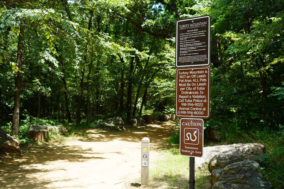
Proximity to Tulsa: If you’re looking for a place to hike in Tulsa, the Turkey Mountain Urban Wilderness Area is perfect.
Trail Details: With roughly 45 miles of dirt trails, Turkey Mountain has some of the best hiking and mountain biking trails. The Wilderness Area includes over 600 acres.
Choose to hike the Red Trail (0.8-mile loop), Blue Trail (1.5-mile loop), Yellow Trail (4.4-mile loop), or paved trail, which connects to the Tulsa River Parks Trail System.
Check out the Turkey Mountain Hiking Trail map to plan your adventure.
Why We Love Hiking Here: The trails are accessible year-round, making it an accessible escape from city life.
Best Time of Year To Hike
The best time of year to hike in Oklahoma is definitely outside of the hot summer months. The weather is beautiful from October through May. There are fewer bugs, and the trees and brush aren’t as dense. Spring, fall, and winter make for the best times of the year to explore the hiking trails near Tulsa.
Hiking tip: We like to use the AllTrails app to see the trail maps for hikes.
Final Thoughts About Hiking Near Tulsa

The Northeast part of Oklahoma is known as Green Country. This area is named Green Country for the rolling hills, beautiful hardwood trees, hidden bluffs, and tucked-away rock outcroppings. There are cool places to explore off the beaten path.
All of the trails above make for excellent day hikes and half-day adventures. Reinvigorate your curiosity in the local area and go explore.
Please practice Leave No Trace when exploring the outdoors.
Ashlee & Pablo
Are you planning and outdoor adventure but aren’t sure what to pack? Get a FREE packing list and gear guide from us detailing exactly what we take on a camping and hiking trip.
Get More Oklahoma Adventures:
- 7 Unique Oklahoma State Parks to Add to Your Bucket List
- 14 Best Outdoor Weekend Getaways & Day Trips From Tulsa
- The Ultimate Tulsa Bucket List From a Local
- 5 Fun (Free or Cheap) Outdoor Things To Do in Tulsa
- How to Spend 48 Hours in Tulsa – Local’s Guide
- The Ultimate Guide to Quartz Mountain State Park
Follow The Happiness Function on Twitter, Instagram, Facebook, TikTok and YouTube.

21 years in Custer, but I have never hiked !! These hikes seem fun to me…maybe someday !!
Hi Uncle Burt! Thank you for reading! Wow, 21 years is a long time.
Me encanto este relato y las fotos.Infinidad de lugares para caminar y disfrutar tanta belleza de la naturalezaEl parque Natural Falls hermoso.
La Pradera de los pastos mas altos del mundo me sorprendio que fuese el hogar de 2500 bufalos.
El lago Oologah que bello y que cerca que les queda a Uts,Tambien el rio Tulsa.
que maravilla la cantidad de aves y de arboles de madera dura.
Como no disfrutar tan bello lugar.
¡Hola Cristina! Gracias por leer y comentar. Esperamos que pueda visitarnos en Oklahoma algún día.
I love hiking and these trails look beautiful! I will definitely have to check them out when visiting Oklahoma!
Hi Gabby! Thanks for reading. Have a great visit to Oklahoma next time you come by.
Love the tips on difficulty and if they are dog friendly! The two most important things to me ☺️. They look like great hikes!
Hi Tiffany! Same here! Thanks for stopping by.
Hi Tiffany! Yes, dog-friendly is important. I know you are a dog lover!
This looks like my kind of hiking… mostly flat!! LOL I love the way you have the bullet points for each hike. What a nice easy way to organize the information.
Hi Susan – thanks for stopping by. Haha, yes, mostly flat and shorter distances. You would have a nice time.
Loving all these hiking posts! Such a great experience to get outdoors. Hiking has been my sanity during the past year!
Hi Sarah – thanks for reading and commenting. Same here on hiking for sanity during COVID!
I’d like to try some of these trails. They are such a different ecosystem than I’m used to. I like the lists of flora and fauna you included.
Hi Karen – you would have a great time!