Guide To Hiking the Hideout Hollow Trail in Buffalo National River

This article is a detailed guide about hiking the Hideout Hollow Trail in Buffalo National River.
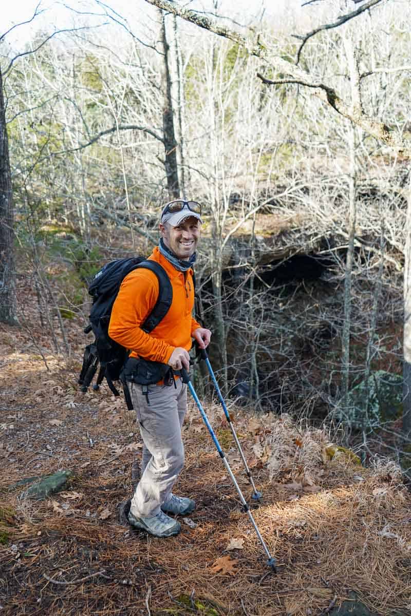
The Hideout Hollow Trail in Arkansas features a beautiful waterfall that cascades over a steep bluff in the woods. The trail is easy to hike up to the main waterfall and is a nice trek for anyone exploring the Buffalo National River area. Since it is a short and easy hike, it pairs well with other short-day hikes in the area.
Keep reading to learn all the details on hiking here, where to camp, and other trails you might enjoy exploring in the area.
This post contains affiliate links, which means we’ll receive a commission if you purchase through our links at no extra cost to you. Please read our full disclosure for more information.
How to Hike the Hideout Hollow Trail
This 2.0-mile out-and-back trek is within the Buffalo National River National Park boundaries.
The trail takes hikers through the woods to a steep bluff ledge with a waterfall.
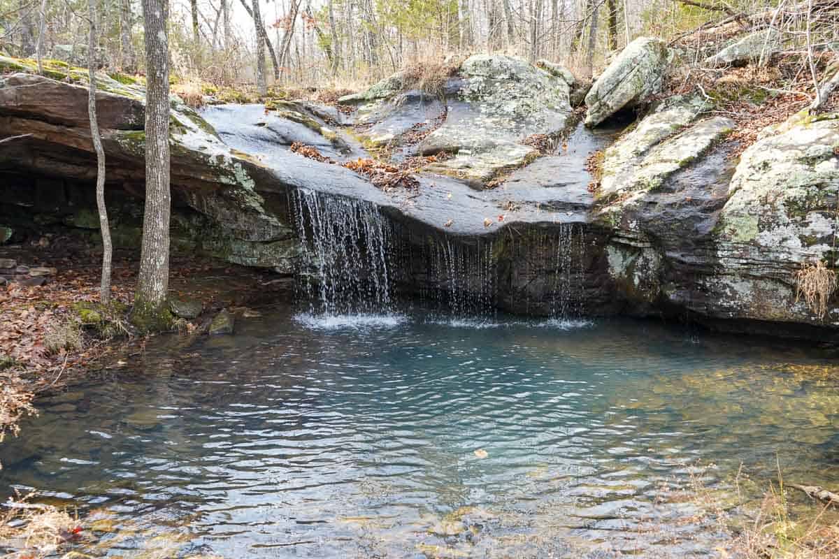
Once hikers get to the main bluff waterfall, you can hike a little further upstream to see another small waterfall. Or, you can cross the stream upstream of the bluff waterfall and make your way down into the hollow to see the waterfall and bluff edge up close.
Getting down into the hollow is tricky, and if deciding to get up close to the waterfall, know that it is slippery and a more challenging hike. Also, there is not a trail down into the hollow to see the waterfall up close.
So, you can choose your own adventure here—keep it easy or venture into the hollow.
Cell phone reception is hit-and-miss in the area, so be careful going off-trail.
Where is the Hideout Hollow Trail?
The Hideout Hollow Trail is located near Compton, AR. Here is a Google map to help you orient yourself.
Hideout Hollow Trail Details
The trail begins at the Hideout Hollow parking area.
The small parking area is not that well marked and is mostly a small pull-off from the gravel road. A small trail sign nailed to a tree says, “Hideout Hollow.”
This sign is facing the dirt road and may not be noticeable.
- Distance: 2.0 miles
- Elevation Gain: 311 feet
- Route Type: Out and back (O&B)
- Difficulty: Easy
- Are dogs allowed? No
- Is there a fee to hike? No
- Are there restrooms available? No
The nice thing about this hike is that it’s an easy jaunt along a few rolling hills. It’s very flat until you approach the bluff. Once you get to the canyon, rocks become more prevalent, and there are some scenic views.
If you want to get into the hollow and see the waterfall and bluff shelter up close, you’ll have to cross the creek upstream at the top of the falls. This is where things get a little steep and can be slippery.
You’ll have to climb down to get to the base of the waterfall, and there isn’t a clear path to follow. You will probably want to go into the hollow for the best photos.
If you don’t want to go into the hollow, then stay on the same side of the creek and continue following it upstream to the other small falls (pictured above).
How Long is the Hideout Hollow Trail?
The trail is two miles long and takes about an hour to hike.
Shop Hiking Boots (We Love):
Cell Phone Reception Is Limited
This wilderness area is generally pretty remote, and cell phone reception is hit-and-miss.
We did have enough cell phone reception to use our AllTrails app while hiking this trail (which is rare for the area).
More Great Trails in the Area
The Ponca and Upper Buffalo area has some great trails to explore.
Here are some of our favorites:
- Centerpoint to Big Bluff (Goat Trail)
- The Lost Valley Trail
- Hemmed in Hollow Trail
- Glory Hole Falls
- Balanced Rock Falls
- Whitaker Point Trail to Hawksbill Crag
- Eye of the Needle
Best Time of Year to Hike Hideout Hollow

Spring and fall are excellent times to hike in the Buffalo River area.
The weather temperatures are pleasant during the spring, the foliage is greening up, and the waterfalls run a larger volume of water.
During the fall, you can enjoy cooler temperatures, no bugs, and the leaves changing colors. However, the waterfalls might not be as grand if the area hasn’t received much water. After Thanksgiving in November, the crowds tend to die down in the area.
We hiked in late December. We were the only ones on the trail; the water was running enough to see and hear the falls. We really enjoyed the small waterfall upstream.
Camping Nearby
There are some great places to camp in Buffalo National River. Close by, there is:
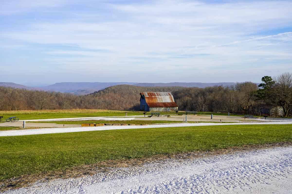
Buffalo Outdoor Center RV Park – The RV Park is about 20 minutes from the Compton Trailhead, making it a nice place to camp and explore all the hikes in Ponca. This is your place if you have an RV, camp trailer, van, or motorhome. They have hot water, great bathrooms, and full hookups. We love camping here in our Aliner.
Tents aren’t allowed at the Buffalo Outdoor Center RV Park, so if you are tent camping, you’ll enjoy these campgrounds or Steel Creek below.
Steel Creek Campground – Steel Creek is part of the National Park Service. It is tent camping only and located about 30 minutes from the Hideout Hollow Trailhead. The campground is open year-round; running water and flushing toilets are seasonal. If camping outside of the season, there is a vault toilet.
Make reservations ahead of time at recreation.gov.
Watch Our YouTube Video
Want to see more hiking details for Hideout Hollow?
Check out the video to see the trail conditions and hear the waterfalls.
Our Experience
We hiked Hideout Hollow in late December; no other people were in the area or on the trail. So, we elected not to go down into the hollow and instead drove to the Erbie Campground (YouTube video).
We had so much fun driving the backroads of Buffalo National River. There was even a low-water river crossing.
We camped at the Buffalo Outdoor Center RV Park and loved every minute. Those folks are so nice.
Whenever we explore the Buffalo National River, we always take a topo map (link to buy on Amazon) since cell phone reception is hit-and-miss.
We hope you have a great trip hiking this trail.
Have fun out there.
Ashlee & Pablo
More Arkansas Adventures:
If you love Arkansas as much as we do, check out these other posts on camping and hiking:
Save This Guide for Later
Pin this article on Pinterest for later to plan your hiking trip.


Please practice Leave No Trace while exploring the outdoors.


I love the water, too…have a great time hiking there, next time you guys go. Send me some pictures !!
Hello Uncle Burt! Thanks for reading. XO